History
30/06/2569 จำนวนผู้เขาชม: 12 คน
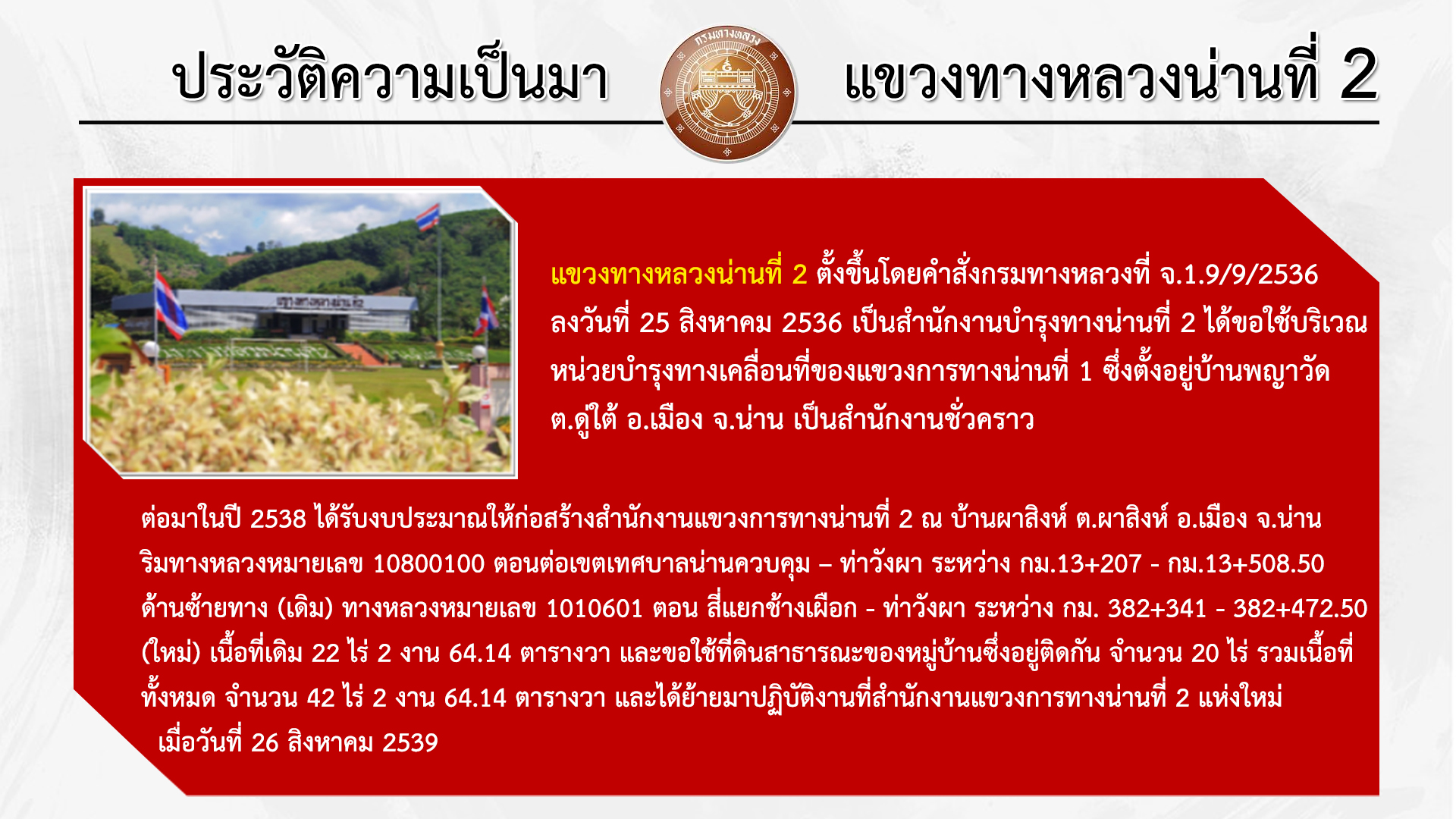
The Nan Highway District 2 was established by Department of Highways Order No. J.1.9/9/2536 dated August 25, 1993. Initially, it served as the Nan Highway Maintenance Office No. 2, using the mobile maintenance unit of Nan Highway District 1, located at Ban Phayawat, Tambon Du Tai, Amphoe Mueang, Nan Province, as a temporary office.
Later, in 1995, funding was allocated to construct the Nan Highway District 2 office at Ban Pha Sing, Tambon Pha Sing, Amphoe Mueang, Nan Province, along Highway No. 10800100, section connecting the Nan Municipality controlled area to Tha Wang Pha, between km 13+207 and km 13+508.50, on the left side of the road (originally). This area is now Highway No. 1010601, section Si Yaek Chang Phueak - Pua, between km 382+341 and 382+472.50. The original land area was 22 rai, 2 ngan, and 64.14 square wah. And permission was requested to use 20 rai of public land belonging to the adjacent village, bringing the total area to 42 rai, 2 ngan, and 64.14 square wah. The office of the Nan Highway District 2 was relocated to its new location on August 26, 1996.
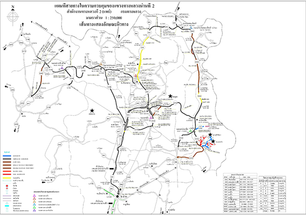
The Nan Highway District 2 connects the northern part of Nan Province to 8 districts: Mueang Nan, Tha Wang Pha, Pua, Chiang Klang, Thung Chang, Chaloem Phra Kiat, Song Khwae, Bo Kluea, Santi Suk, and Pong and Chiang Kham districts in Phayao Province.
- To the north and east, it borders Laos.
- To the south, it borders Phrae Province.
- To the northwest, it borders Phayao Province.
They have a total area of responsibility of 533.869 km.